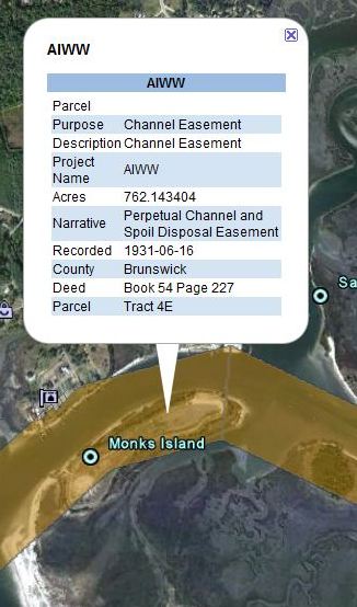
The U.S. Army Corps of Engineers has obtained numerous easements throughout North Carolina for the maintenance and operation of various federally authorized navigation projects. In the case of the Atlantic Intracoastal Waterway, easements were obtained from the State of North Carolina in the 1920's for a 1000 foot easement. All recorded easements, or rights-of-way, can be viewed using Google Earth software. Though Google Earth imagery is not 100% accurate, it can provide property owners a general idea whether an easement may or may not encumber his or her property. All recorded easements provide the Corps of Engineers with particular
access or usage rights. The majority of the easements the Corps of Engineers' possess are for "perpetual channel and spoil disposal", which means the Corps of Engineers can place dredged material on a particular parcel as part of any maintainance or dredging operation of the associated navigable waterway. Users can also click on each easement within Google Earth to view the specific deed book and page information where the easement is recorded.