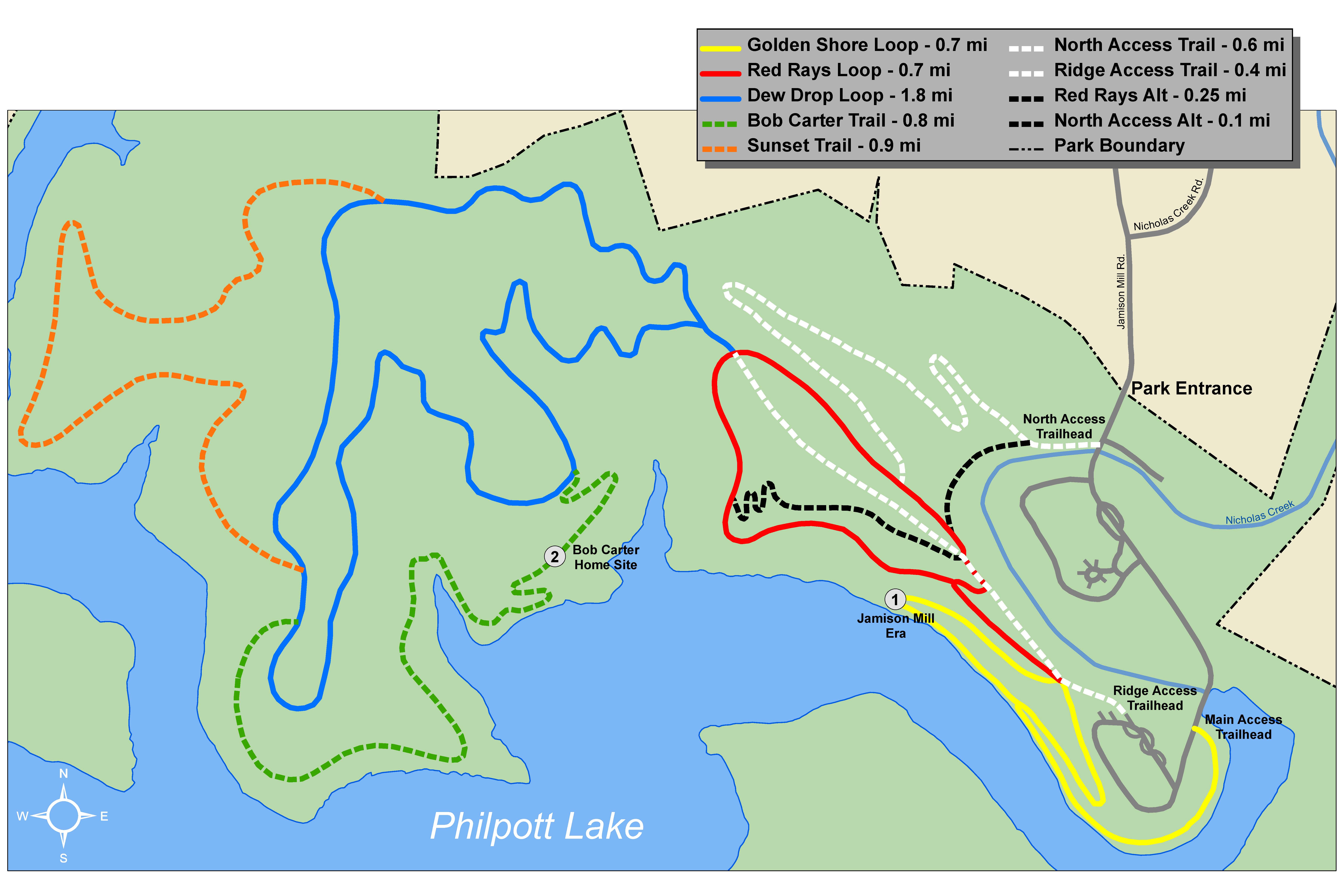
Jamison Mill Trail Brochure
Description: 6.25 miles of inter-connected loops offering a variety of experiences from narrow, single-track trails to wider, fire-road type trails that meander through a variety of landscapes, including mixed pine and hardwood stands. Trail features include stretches along the shoreline of Philpott Lake and beautiful ridge top vistas. Most trails follow the contour, keeping the average grade to a minimum. There are a few short, steep segments with several switchbacks in places.
Directions:
*To Jamison Mill Park from Roanoke, VA: Take 220 S. When you reach the intersection of 220 S and Sontag Rd (SR 619) in Rocky Mount, go about another 10 miles, then turn right onto Henry Rd (SR 605). Go 9.2 miles, then turn left at Nicholas Creek Rd. Go 1.6 miles, then turn left at Jamison Mill Rd. Go 0.1 miles to park entrance.
*To Jamison Mill Park from Greensboro, NC: Take 220 N. Once you pass through Ridgeway, merge onto 220 N toward Roanoke. Go about 19.4 miles, then turn left onto Henry Rd (SR 605). Go 9.2 miles, then turn left at Nicholas Creek Rd. Go 1.6 miles, then turn left at Jamison Mill Rd. Go 0.1 miles to park entrance.
* To Jamison Mill Park from Rocky Mount, VA: Take 40 W for about 14 miles, then turn left onto Henry Rd (SR 605). Go 2.6 miles, then turn right onto Jamison Mill Rd. Go about 2 miles to park entrance.
Rating:
*Golden Shore Loop-Easy
*Red Rays Loop-Easy
*Dew Drop Loop, Bob Carter Trail, Sunset Trail-Moderate/Strenuous
Users: Hikers and bicyclists
Length: Loops of various lengths from 0.7 mi-1.8 mi for a total of 6.25 miles of trail